Çatalhöyük
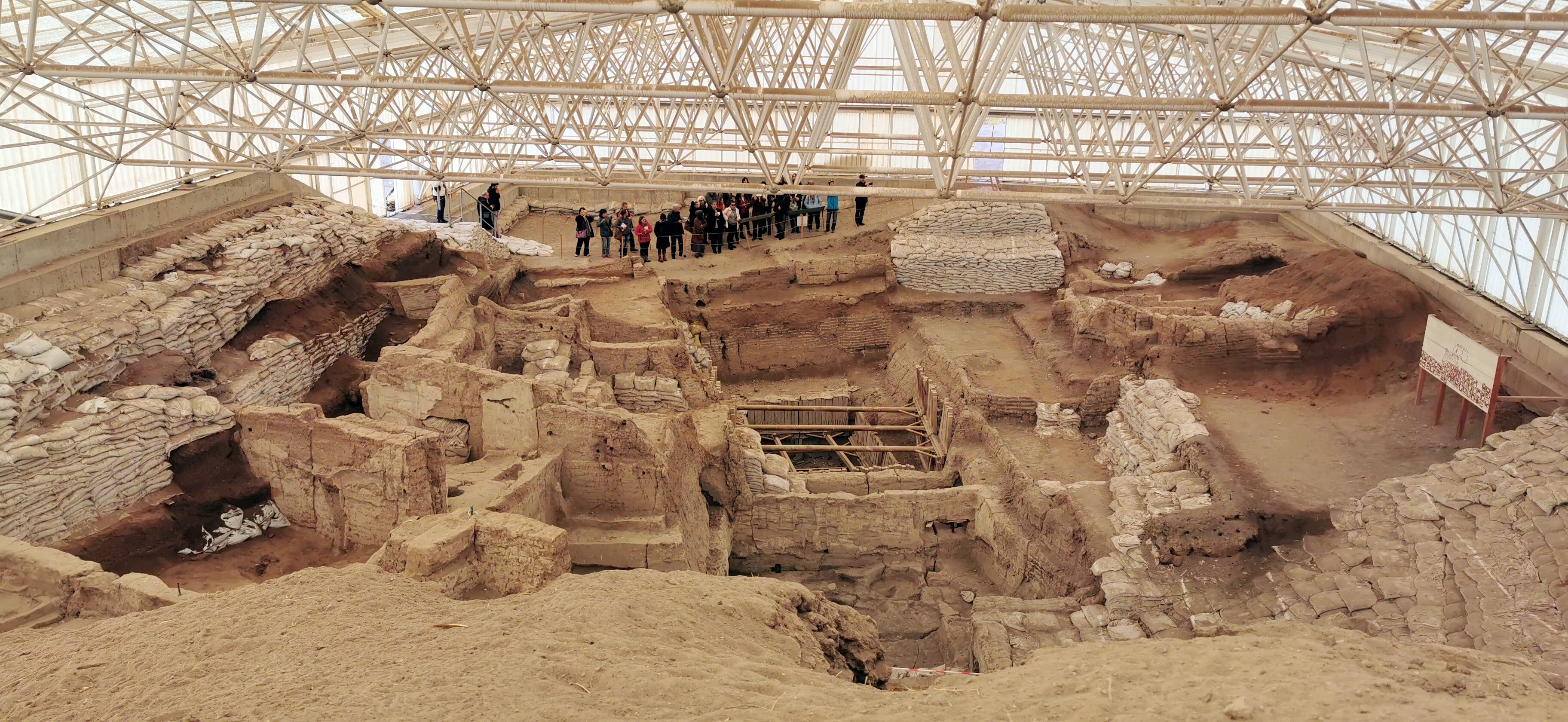
Photo: Murat Özsoy 1958, CC BY-SA 4.0, via Wikimedia Commons
Çatalhöyük is a massive tell (settlement mound) covering approximately 13 hectares in southern Anatolia, representing one of the world's largest and best-preserved Neolithic settlements. The site consists of densely packed mud-brick houses built directly against each other without streets, creating a honeycomb-like urban landscape where residents entered their homes through holes in the roof using wooden ladders. Located about 140 km southeast of modern Konya, the settlement overlooks the fertile Konya Plain with views of the twin-peaked Mount Hasan volcano in the distance. At its peak around 7000 BC, this proto-city may have housed up to 8,000 inhabitants, making it one of the earliest examples of urban planning in human history.
Timeline
Initial settlement established on the Konya Plain
Settlement reaches its peak population and cultural complexity
Site gradually abandoned as population disperses
British archaeologist James Mellaart begins systematic excavations
Ian Hodder launches new international research project
Inscribed as UNESCO World Heritage Site
What the Show Claims
- ›One of the world's first cities with no streets — houses entered through rooftop holes like alien craft hatchesS10E01
- ›Wall paintings depict what appear to be maps of cities and volcanic eruptions — alien-provided knowledgeS10E01S12E16
- ›Human skulls were plastered and displayed — possibly to preserve alien genetic materialS10E01
- ›The site's abrupt abandonment suggests alien departure
What Archaeology Says
Systematic excavations beginning with James Mellaart in 1961 and continuing under Ian Hodder since 1993 have revealed extraordinary preservation of Neolithic life. The site's unique architecture reflects practical solutions to communal living — shared walls provided structural support and defense, while rooftop access prevented the need for ground-level passages that would waste precious space. Excavations have uncovered elaborate wall paintings, including the famous scene showing a town plan beneath an erupting volcano, likely representing the settlement itself with Mount Hasan in the background.
The site's religious and cultural practices are equally fascinating to archaeologists. Residents practiced elaborate burial customs, interring their dead beneath house floors and often removing skulls for plastering and display — a practice archaeologists interpret as ancestor veneration common throughout the ancient Near East. The famous "mother goddess" figurines found at the site, along with bull's head sculptures and leopard reliefs, suggest complex religious beliefs centered on fertility and animal symbolism.
Scientific analysis reveals sophisticated agricultural practices and long-distance trade networks. Residents cultivated wheat, barley, and peas while raising cattle, sheep, and goats. Obsidian tools came from volcanic sources hundreds of kilometers away, indicating extensive trade relationships. The site's abandonment around 5600 BC appears gradual rather than sudden, likely reflecting environmental changes, population pressure, or shifting settlement patterns as communities spread across the region.
Despite decades of research, mysteries remain about daily life organization and social structure. How did thousands of people coordinate activities without apparent centralized authority? The absence of obvious public buildings or elite residences suggests a remarkably egalitarian society, though the mechanisms of governance and decision-making remain unclear to researchers.
Mysteries & Fun Facts
Some houses remained in continuous use for over 1,000 years with multiple generations buried beneath the floors
The site contains what may be humanity's first landscape painting, showing the settlement with Mount Hasan volcano erupting
Residents kept their houses remarkably clean, regularly replastering walls and floors up to 450 times in some buildings
The settlement had no streets or ground-level doors — the rooftops formed the community's main thoroughfare
Planning a Visit
The site features a modern visitor center with interactive exhibits and a protective shelter over ongoing excavations, allowing visitors to observe active archaeological work. Access is generally available year-round through organized tours from nearby Konya, though individual site access may vary depending on excavation schedules.
Konya, approximately 60 km northwest
Spring and autumn offer the most comfortable weather for exploring the exposed archaeological areas. Summer temperatures can be quite intense on the open Anatolian plain.
Related Sites
Gobekli Tepe
Another groundbreaking Neolithic site in Turkey that predates Çatalhöyük and challenges assumptions about early civilization
Harappa
Represents the next stage of urban development in the ancient world with more complex city planning
Ur / Ancient Mesopotamia
Shows the evolution of urban civilization in nearby Mesopotamia following similar early settlement patterns
Featured In2 episodes
Historical data sourced from Wikipedia